DPPA
Geospatial Dashboards for Climate Assessment and Early Warning
© CRAF’d
ABOUT
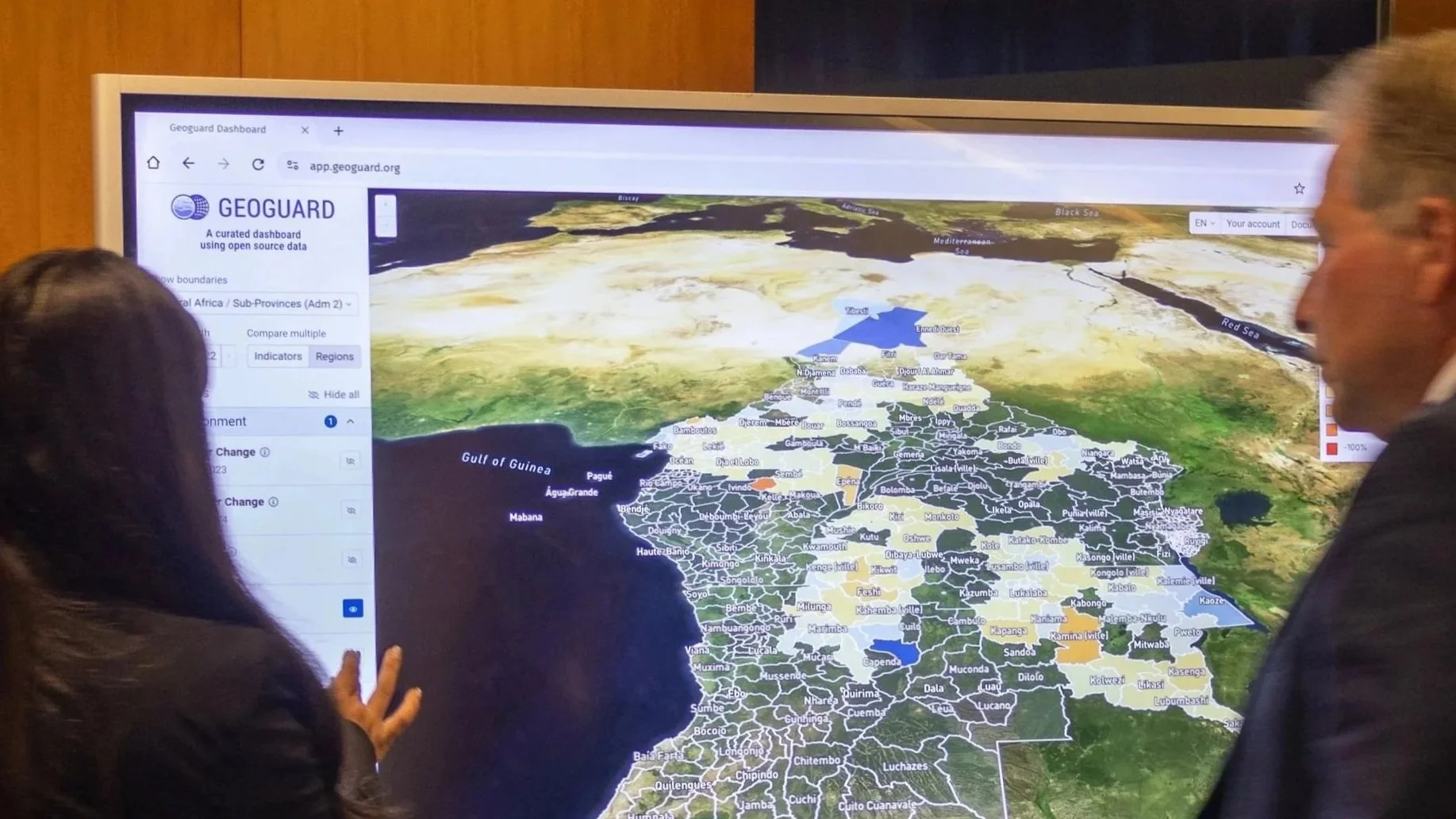
Developed by DPPA’s Innovation Cell with academic partners, Geoguard is the first geospatial dashboard designed to help decision-makers understand links between environmental risk and conflict dynamics. Integrating millions of geo-coded conflict events with environmental indicators, the platform aggregates diverse data sources into an accessible analytical tool. By providing timely insights across the Middle East, Central, and West Africa, Geoguard enables partners to anticipate risks, strengthen climate security analysis, and support earlier crisis prevention and response.
OBJECTIVES
Through CRAF’d support, DPPA expands the reach of the Geoguard across 29 countries, strengthening analysis of environmental and conflict risks. The initiative deepens integration between geo-coded conflict data and environmental indicators while incorporating locally sourced and crowd-generated information. These improvements enhance early warning systems, support climate security decision-making, and enable partners to anticipate crises earlier and respond in a more coordinated and targeted way.

CRAF’d has been an enabler of Geoguard, an analysis tool developed by DPPA, which helps harness open-source satellite data for insights into the links between climate, peace, and security. This has contributed to DPPA’s commitment to the UN 2.0 Agenda, demonstrating how strategic funding can strengthen innovation in prevention efforts.
Rosemary A. DiCarlo
Under-Secretary-General for Political and Peacebuilding Affairs, United Nations
“
UPDATES
-
![]()
SNEAK PEEK
The CRAF’d-supported Geoguard dashboard uses geospatial technology to keep a pulse on water resources like never before, giving UN and partners a headstart when it comes to data-driven decision making.
-
![]()
COP28 SOLUTIONS PACKAGE
Recognized in the COP28 Package of Solutions, DPPA’s Geoguard drives climate, peace, and security. With CRAF’d support, it helps partners anticipate, prevent, and respond to risks, improving timely decisions for at-risk communities.
-
![]()
DATA FOR PEACE
At the Data for Peace Conference, UNDPPA’s Innovation Cell brought together practitioners and scholars to explore emerging trends and potential innovations in utilizing geospatial data for conflict resolution and peace efforts.